Winter Seasonal Forecast 2 years ago
October 27, 2023
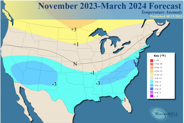
- There are no changes to the overall forecast.
- Unlike last year, the worry is it will be colder than what we have out.
- A major stratospheric warming event may unfold in December, with some who's who of worst winter analogs in that group.
- While the ONI is very warm, the MEI, SOI, and TPI are not coming along for the ride.
- This means the standard El Niño analogs are questionable.
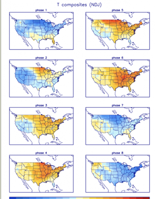
- The MJO is expected to be centered in Phases 8 & 1, not Phases 4-6 like last year.
Snowfall will be crucial. Larger amounts in the heart of the season have occurred in the analog years and would mean colder temperatures:
.png)
New analog:
.png)
I am not going to rehash everything I had out before, but I will add some key points.
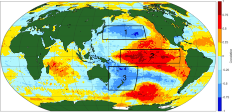
First of all, there is a strong El Niño by way of ONI standards (the Oceanic Nino Index). There is a big disconnect, however, with the Multivariate ENSO Index, the Southern Oscillation Index, and the Pacific Tripole (measures of the atmospheric response). In fact, we have never seen anything like this, and a look at the SSTs explains why:
.png)
There is little cold water anywhere, so the difference in temperatures (relative SSTs) is nowhere near the standard El Niño, which typically has cold water in the North Pacific near 40°N and the South Pacific near 40°S. For instance, the 2015 Super El Niño looked like this:
The 90-day SOI is in a weak El Niño state (-8 to -12) and for the month is not even to an El Niño. It's running close to 2002 and way under the warm El Niño winters of 1997-98, as is the MEI, which is at +0.6 (it was over +2.0 in the warm El Niños).
A look at the JMA upward motion pattern last year showed the two pigs fighting, with the feedback being a strong warm signal. Last year:
That lined up with the warm phases of the MJO:
Correlations:
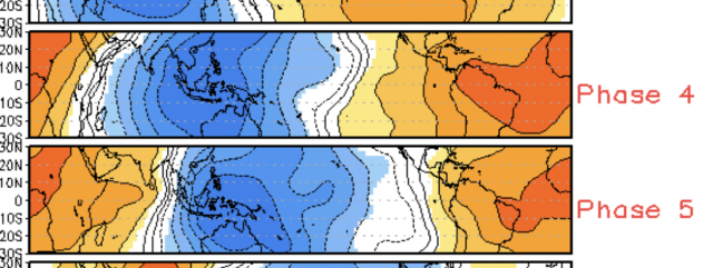
This year, the forecast is for the exact opposite:
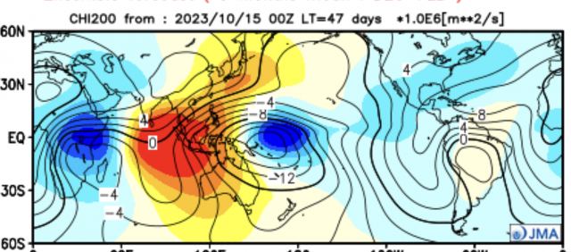
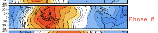
That looks like Phase 8.
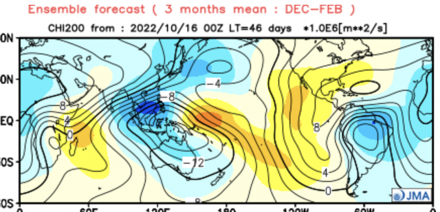
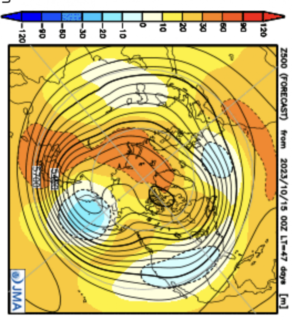
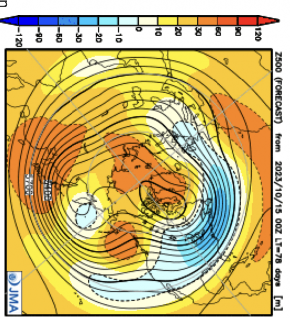
The response can be seen in the JMA winter forecast:
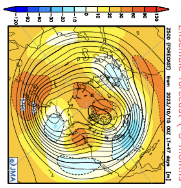
That configuration of ridging leaves the door open for widespread severe cold from mid to late December into February, as the JMA monthly forecast for December shows the jet working across:
Then it has the whip come down in January:
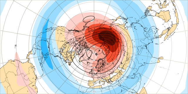
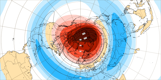
The plot thickens when looking at the major stratospheric warming that is forecasted to evolve on the Euro from late November into December.
The week ending December 4:
The week ending December 11:
There have been 25 or so of these since 1950 and the blend from the late 1960s onward looks like this:
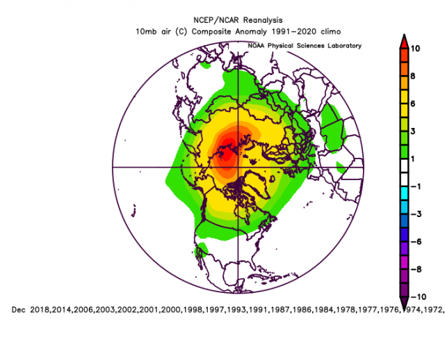
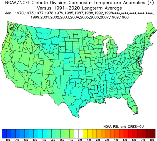
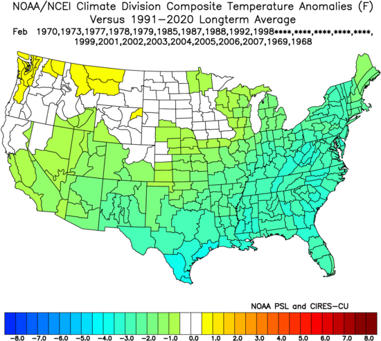
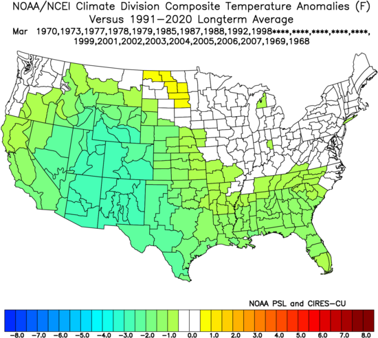
The winter seasons in those years were, on average, cold. December:
.png)
January:
February:
March:
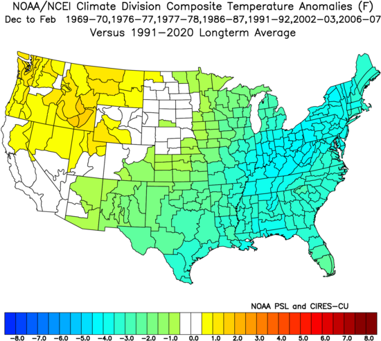
There are some warm ones in there to blunt the severe cold ones. Those warm ones share in common a strong magnitude TPI - either greater than 1 (La Niña) or less than -1 (El Niño). This year it's in the middle and the ones in the middle when there is a December stratospheric warming event have had some of the most severe winters.
If we take the years within 0.3 of the current TPI with December stratospheric warnings, the following winters look like this:
The Verdict
I have not changed the maps but have shown what I fear the greatest threat is this year. Last year we nailed the cold December but the forecast was centering the cold in the center of the U.S. because I did not know which MJO signals would win out. This year I am much more confident colder signals will win out. With them is the threat of a widespread cold winter.
The other change from last year is that I don't expect winter to wait until mid and late winter. In fact, it may be the 45-60 days centered from mid-December to mid-February that can steal the show. There is a lot of potential here and it is not your standard El Niño. Europe will also share in the cold threat.