Winter 2022-23 Preliminary Forecast 3 years ago
September 7, 2022
- A slew of analogs is being used for the upcoming winter season.
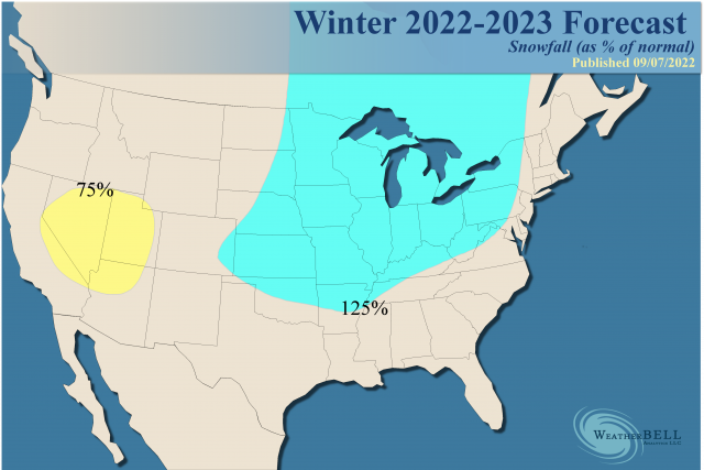
- The snowfall forecast focuses the most snowfall on the Midwest.
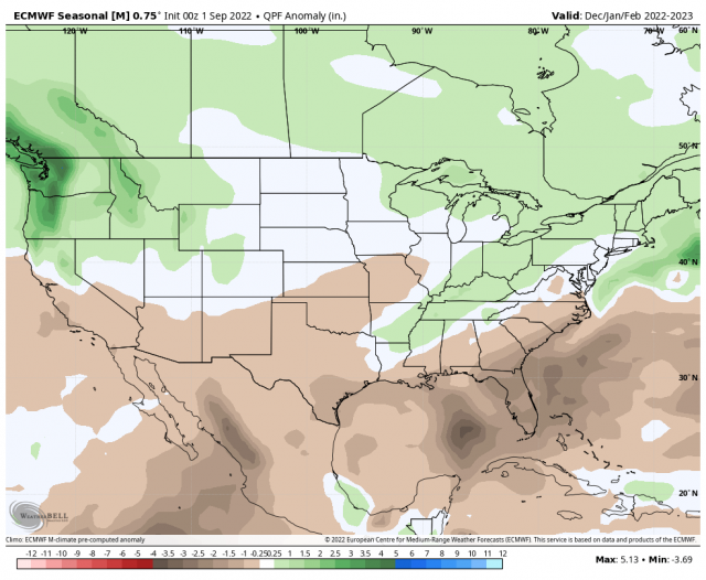
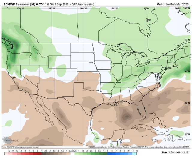
The Euro precipitation forecast outlines the major areas of concern with our snowfall outlook.
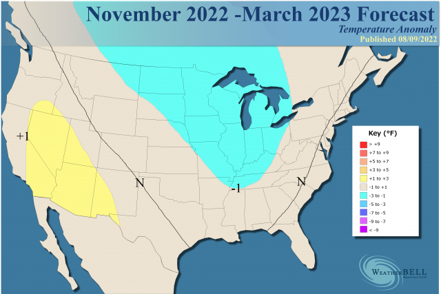
December-February:
January-March:
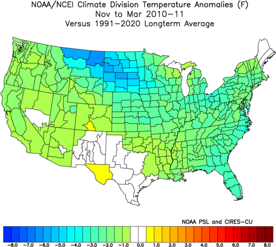
I am intersecting the coldest and wettest areas. However, remember what happened last year. There was a split with coastal areas in the East having plenty of snow, but areas farther back had less (before we resumed with more or less the anticipated pattern).
The pure analog looks like this:
Adjusting that by 1°F for the 5-month period looks like this:
.png)
The analog in the source region of the MJO is very close to 2010. The western Pacific in 2010 was as quiet, as this typhoon season has been so far. This is a sign of a large-scale pattern involving Asia, the Indian Ocean, and the tropical western Pacific.
One thing that is very close to that year is the state of the Indian Ocean Dipole with a La Niña.
.png)
This is similar to what is evolving now.
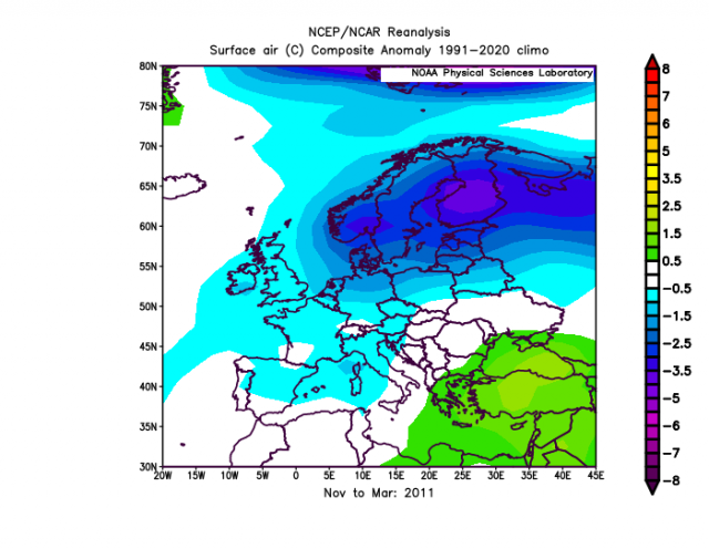
Europe responded by being colder also:
The new analogs are homing in on the distorted warm water pattern. There is simply nothing as extreme as this year, so we have to simply look at the similarities but understand this year is stronger.
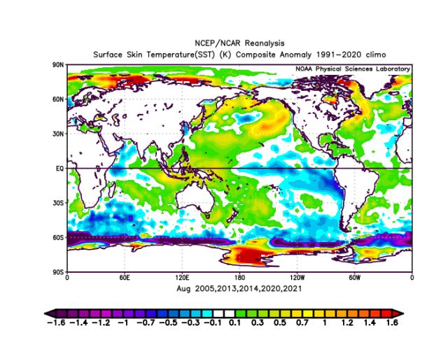
This year:
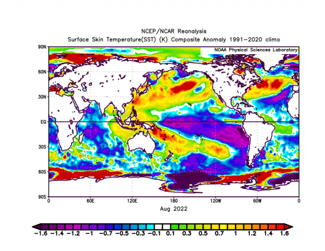
It's like the map above, except on steroids.
So the 500 mb analog with that turns out like this:
.png)
The entire period is like this:
.png)
In that package, you had the warm winter of 2005-06.
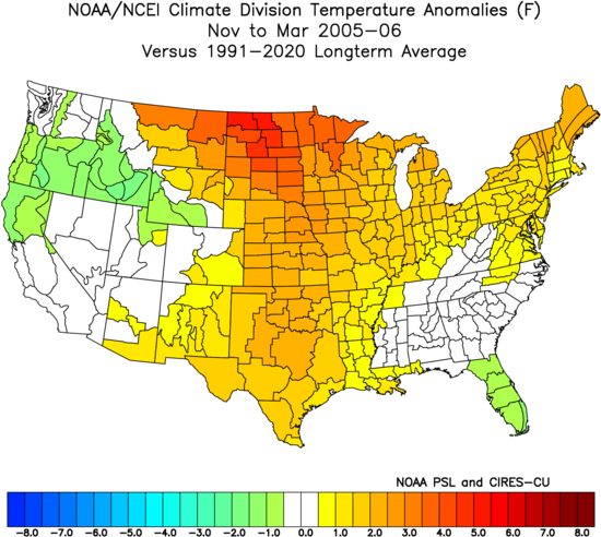
There were also the very cold ones that showed up, like 2014-15:
.png)
So you have two members in the same family with opposite results. Continuing to blend them all together by the month, we have the following.
November:
.png)
December:
.png)
That leads to a paraphrasing of Rocky Balboa that I will attempt to address in the Notes and Asides, when he said, "You gotta be a moron, a complete moron, to want to be a fighter." The weather says, "You gotta be a moron, a complete moron, to forecast a cold December (given what has happened over the last few years)."
January:
.png)
The February analogs have been cold:
.png)
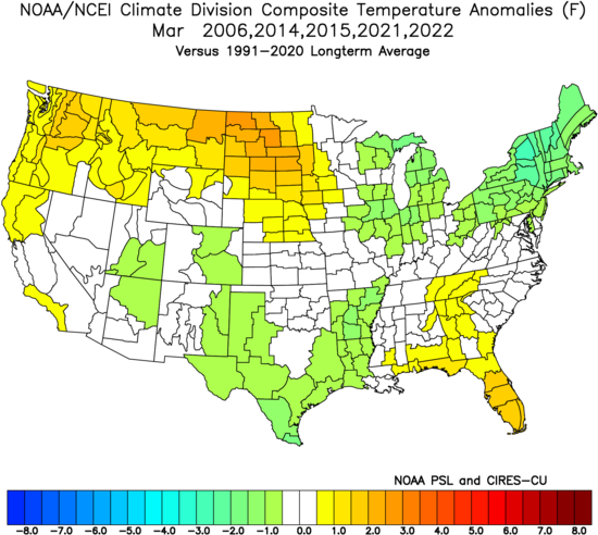
In March, they back off:
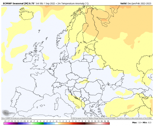
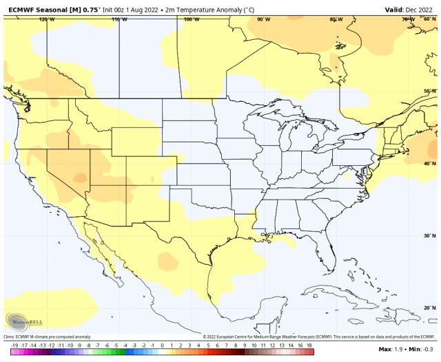
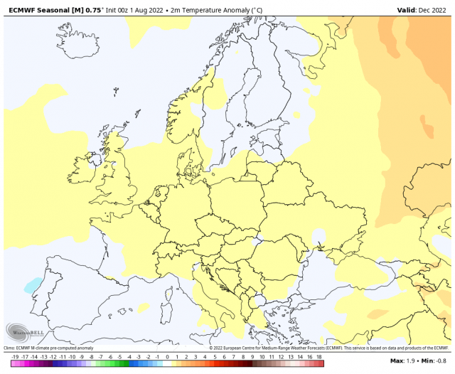
Supporting this, in a way, is the European Seasonal. If we look at past seasonal forecasts, for instance, last year we saw the model finding a trough in western North America. The run last month had what looks to be a negative EPO developing:
.png)
In a way, given the model's weaknesses of not being able to see cold air, that looks like the analogs. However, the new run is more like what happened in 2020-21 with more positives over the top but more trough farther back.
.png)
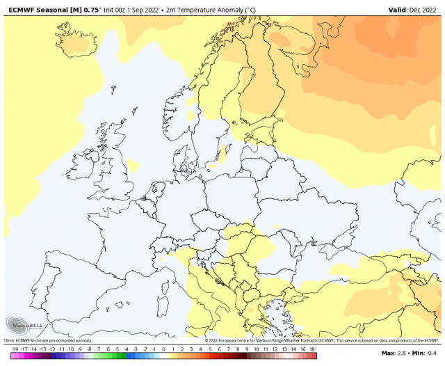
That pattern is a real problem for Europe, as it implies undercutting and a trough over Spain with positive over Greenland and Iceland. WeatherBell's fear is there will be a sudden snap to a cold winter. The analogs support that and the Euro, for a model that can't see cold, is about as bullish as you will see with a climate model in this warm era.
Meanwhile, the Pioneer models, which if it's going to be cold is the one that loves to nail it, has this:
The Verdict
I am looking for a different winter this year versus the past several years. While the total may wind up fairly close, it's December where there may be a big difference. The bottom line is we have a relatively bullish winter forecasted. When we look at snow, that is likely to be above normal in much of the nation from the Plains to the East Coast.
Notes and Asides
The mystery of October hurricanes and the (early) winter continues. The theory I have is that the pattern that produces the needed upward motion patterns for U.S. hurricane hits in October is MJO-related to some degree. Since the MJO is a 40-60 day cycle, it may show up again right in time for later November and December.
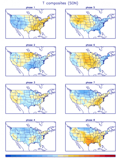
For instance, take a look at MJO temperature correlations for Phases 8, 1, 2 & 3 centered in December:
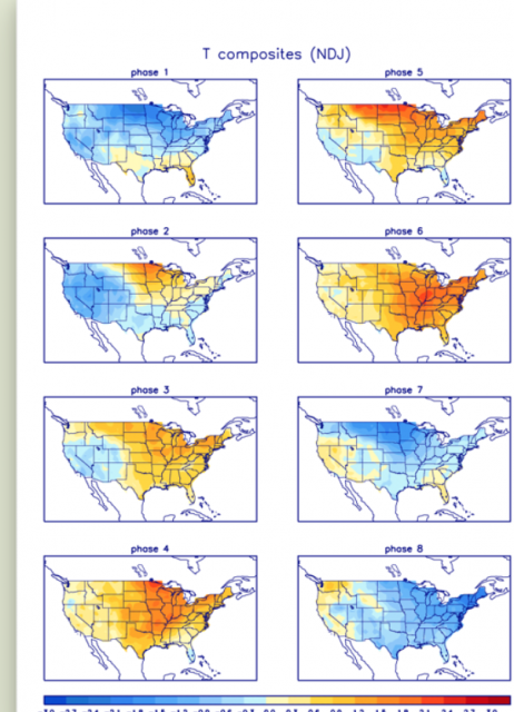
Phases 7, 8 & 1 are very cold, but then it backs off in Phases 2 & 3. Notice in October Phases 8 & 1 are quite warm.
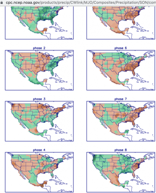
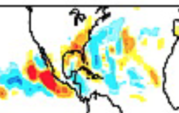
The MJO precipitation correlations in October are very wet over the East and South in Phases 8, 1 & 2:
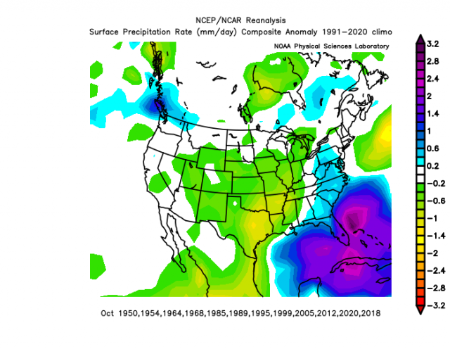
For precipitation, the years hurricanes have hit the United States in October look like this:
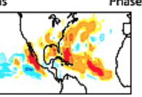
The Euro precipitation forecast for October looks like this:
.png)
Meanwhile, the current CFSv2 October temperature forecast:
.png)
That has the kind of widespread warmth that is seen in the years hurricanes have hit the U.S. in October.
Combine that with Vitart et als. hurricane correlation for the MJO, and you have something. Phases 8 & 1:
Phases 2 & 3:
The late-season rotation into these phases and the correlation to precipitation and hurricane hits have to be linked. Then what of the following December? This needs two steps to look for.
First, do we get this late-season rotation? The Australian seems to think so:
.png)
Once there, do we get a hurricane hit? Or at the least the precipitation and temperature pattern that would typically result. Suppose we do. What do the winters look like?
November-March:
.png)
November:
.png)
December:
.png)
Is there any sign of this in modeling? Last month, yes there was.
This month, it's warm.
.png)
Interestingly enough, it is all-in for Europe (as much as it can be):
It has done a complete flip there, opposite of the U.S., which makes little sense given the eastern U.S. and Europe are known teleconnections:
The Euro's 500 mb forecast for December is hinting at blocking and the trough along the East Coast:
.png)
Still, in the end, the paraphrasing of Rocky lurks (see above). I tried it last year and got burned as the cold air waited until January. Then again there was no October hurricane hit. At the very least you are seeing things that aren't shown anywhere else.