Summer 2017 Final Outlook 8 years ago
May 24, 2017
- Cooler looking June.
- No changes to July.
- August still widespread warmth.
- The forecast package has changed slightly from the previous idea (not as warm)
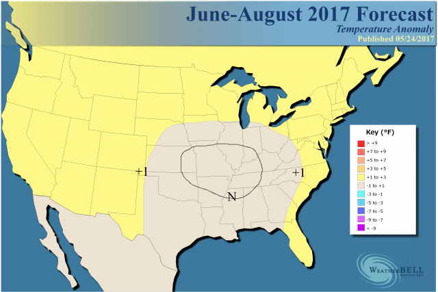
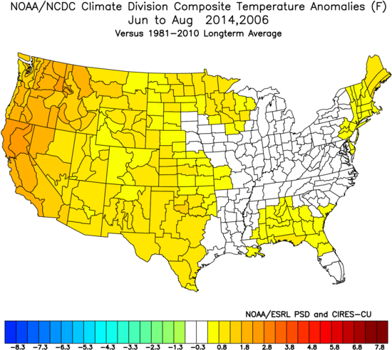
The analog:
We are targeting an area farther to the south and east than what CPC has for cooler temperatures. Note that CPC produces guidance but not a forecast, as a forecast has to have a metric like temperature deviations that can be measured, not a probability of an occurrence that has a 1 in 3 chance (where 40% defines a positive). We are certainly warmer than their implications in the North. This is not to criticize them, it's to (a) show the difference with where we have a cooler forecast and (b) point out that it's guidance is a tool to the answer, but not the answer. The wet areas are where we are most concerned about cooling.
.gif)
June
Changes were made to the June forecast yesterday to account for the wet soil and wet weather in the forecast, while still respecting the warm water off the East Coast.
.png)
Analog:
.png)
The longer term forecasts appear to remain transient, and transience won't allow heat to hit and hold.
July
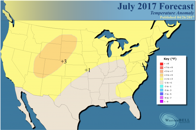
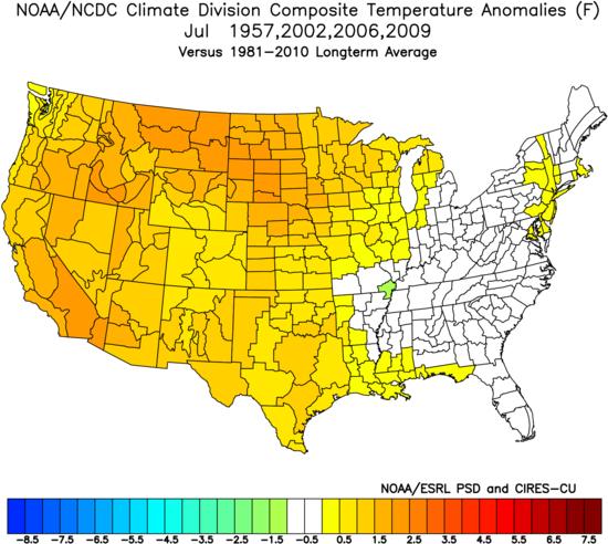
Analog:
No changes were made to July. There is still considerable uncertainty, but it appears the warmth will shift westward. The Southeast may begin to feel the effects of the developing El Niño, and that may leave a cooler "shadow" there.
The idea here is that the ridge we see on the Euro in the first week of July is strong enough to force the warming we have.
.png)
The 45-day precipitation amounts show drying overall in the areas we target for warmth.
.png)
I am concerned about it being cooler from Texas into the interior Southeast. The warm water off the East Coast is likely to start leading to the warmth that we have there, if not with high temperatures then at least with keeping nightly lows elevated.
August
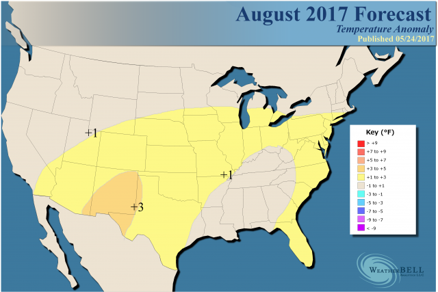
The analog:
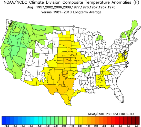
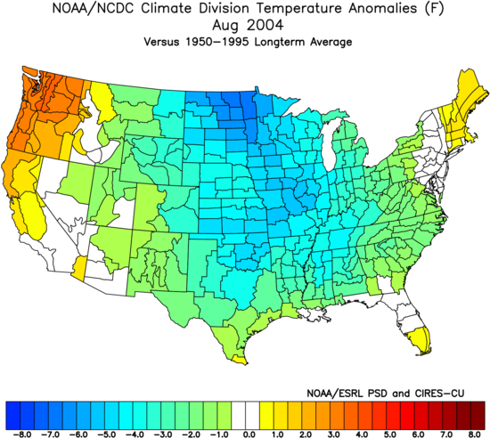
This will be interesting. As summer wears on, the assumption that the El Niño starts to develop may have a bigger effect than in the front months of summer, during which soil moisture is a bigger deal. However, there is still debate on that, and I will spend more time on it in the 180-Day forecast, since the August correlation is all over the place. For example, we see a very cold month for the weak Modoki event of 2004:
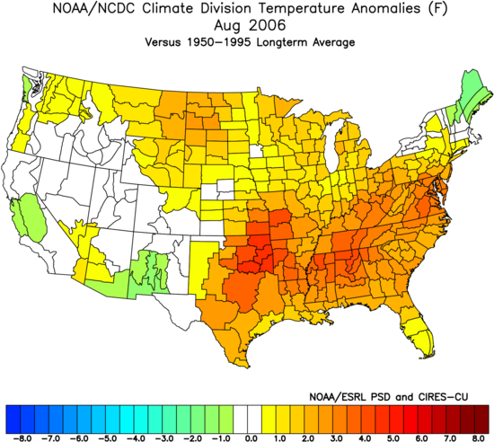
The opposite pattern occurred in 2006:
The current European looks like this:
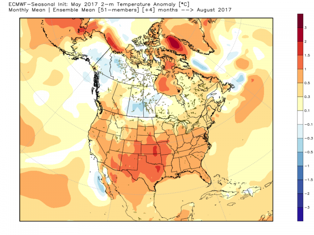
Now this forecast from the Euro was issued on May 8, and you have to wonder how it's turning around so much in the rain-soaked areas in the southern Plains. Then again we have an analog in 1957, which tried to turn around:
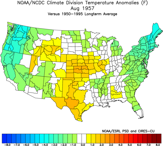
I am using normals from 1950-1995 as normals now are warmer (1981-2010), but I want to show a warmer option given the modeling looking warmer. The point is the Euro turning it around is mimicking, though warmer than, what happened in 1957.
The CFSv2 is opposite, as it won't get rid of the cool:
.gif)
So August is cautiously warm.
The Verdict
Heavy rains in June are leading us to a cooler look for that month; however, drying across the North and ridging starting to show in July out West lead to the idea that warmth will make a comeback. The question is from Texas to the interior East, where rains over the next five weeks are going to be heavy. I have faith in the warm SSTs doing their job near the East Coast as the summer wears on, but the question for mid and late summer is will the cool pool shrink? The Euro suggests it reverses but other modeling says it holds on and remains a significant impediment to CDD accumulations.
Notes and asides
The hurricane discussion is on line: https://www.weatherbell.com/updated-2017-hurricane-outlook