Propane 20-Day Weather Forecast 12 years ago
NOW AVAILABLE FROM WEATHERBELL ANALYTICS: Heating Degree Day and Cooling Degree Day values by city, state, gas region and census region for the 5-day increments shown below. High and Low daily temperature forecasts are also available for several weather models (including ECMWF) for over 1600 cities in the United States. Please contact us at sales@weatherbell.com for more information.
This 20-day forecast will be available weekly, every Wednesday. If you are interested in more weather content and analysis from WeatherBell Analytics, please contact us at sales@weatherbell.com.
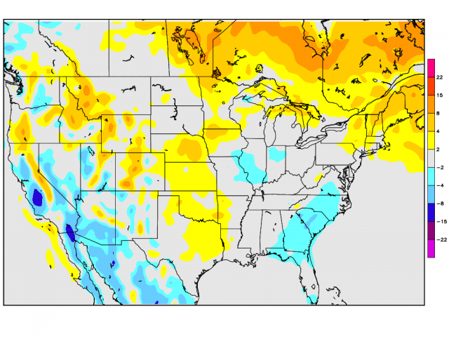
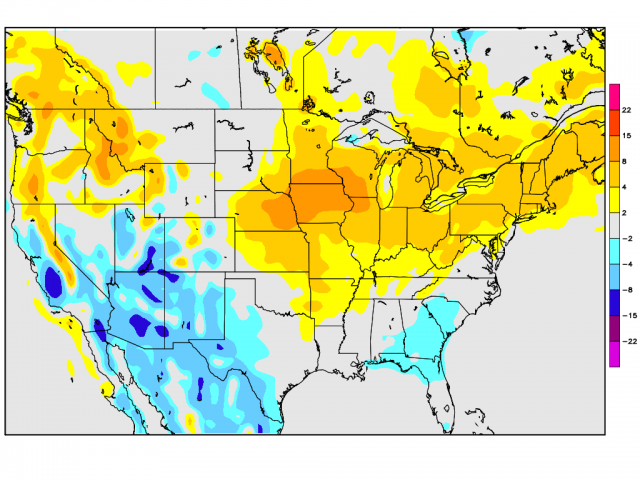
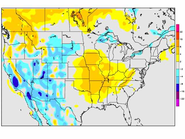
The maps below are temperature anomaly maps over 5 day intervals. The scale to the right of each map shows the color scheme for departure for normal in Fahrenheit.
July 3, 2013
Days 1-5
Confidence: High
Days 6-10
Confidence: High
Days 11-15
Confidence: High
July 10, 2013
A significant phase 3 MJO shot of hot is coming out for week two, followed by a turn to cooler again. I love what the CFSv2 is doing. It has been far superior in the southern plains heat for instance (Dallas hit 100 yesterday) and captures the essence of where this pattern is going. So, I am going to show you its run from 18z yesterday in 5 day increments all the way out to late August and its rest of July, August idea.
Keep in mind, July through the first 9 days looks like this:
.png)
So when we factor in the next 3 weeks looking like this:
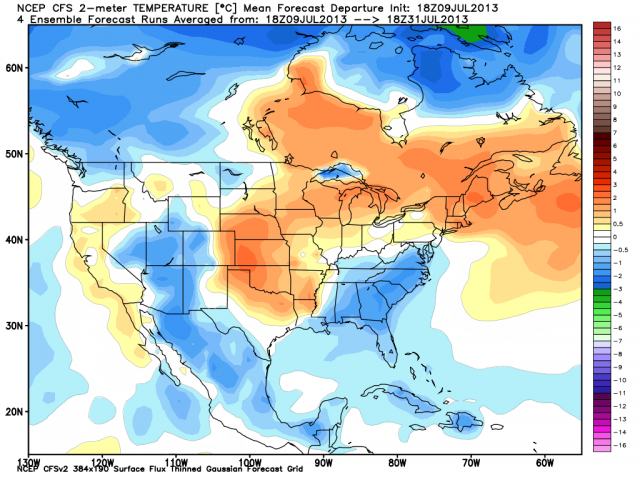
The forecast idea we had for the month will have captured the cooler area that is the shadow. But, we do have 10 days of heat, centered in the western high plains but nosing toward the lakes and Northeast coming out, blunted to the south and east. Again, this is in line with the phase 3MJO, and the progression of the MJO and seasonal variation carries through after that!
.png)
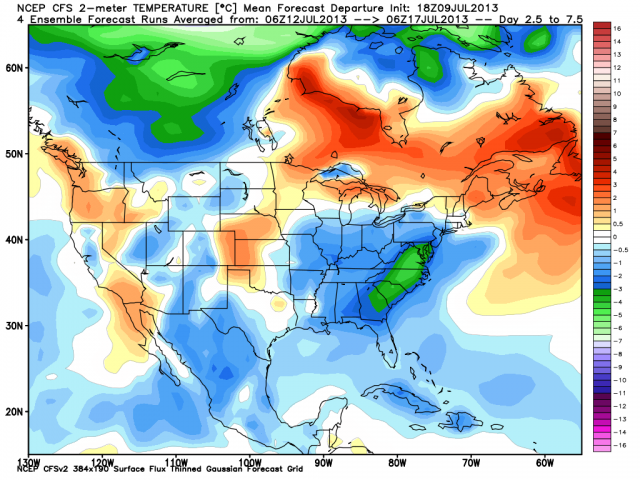
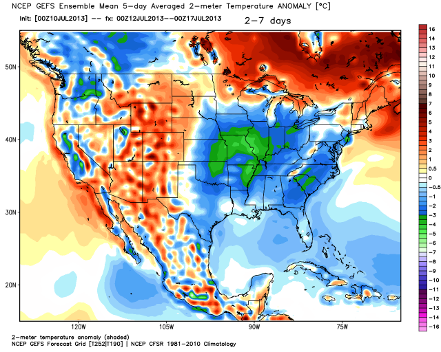
So here are 5 day increments starting at day 2.5 (tomorrow, as this is a run from yesterday) and then carrying on through. Again, if we look at day 1-6, 6-11,11-16 on the GFS, you can see the major 2 meter differences and why the ensembles are no good on that. THE GFS 2 METER ENSEMBLE TEMPS ARE A JOKE IN THE PLAINS
CFSv2:
GFS ensemble:
CFSv2:
.png)
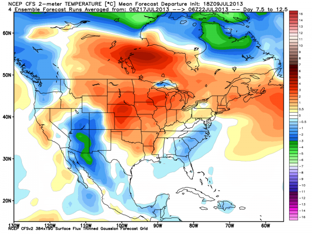
CFSv2:
.png)
I am going for a heat wave for the Midwest and lakes (first one of the summer in Chicago if 3 days of 90 is a heat wave) and another in the Northeast, but for many, this could be the last of the summer! Lets look at what happens beyond.
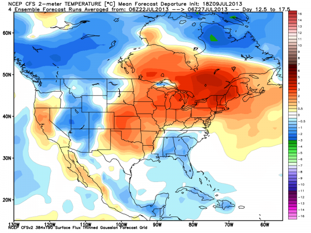
In 5 day increments, day 17.5 on:
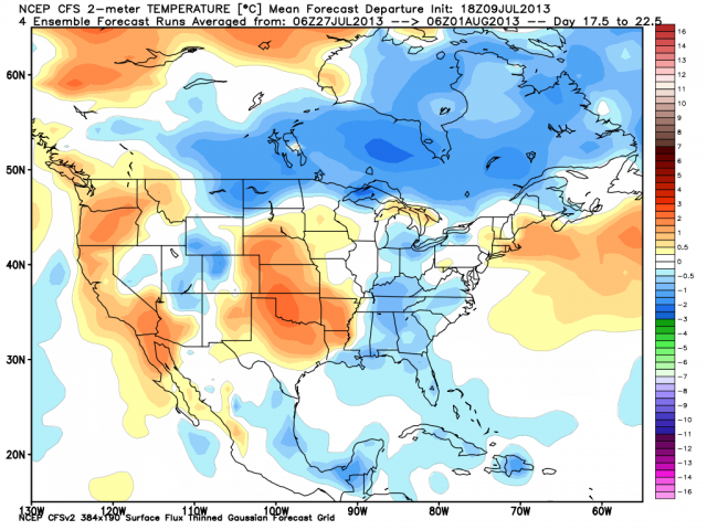
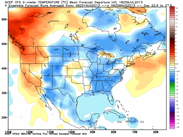
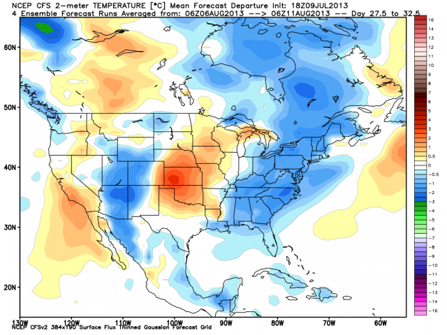
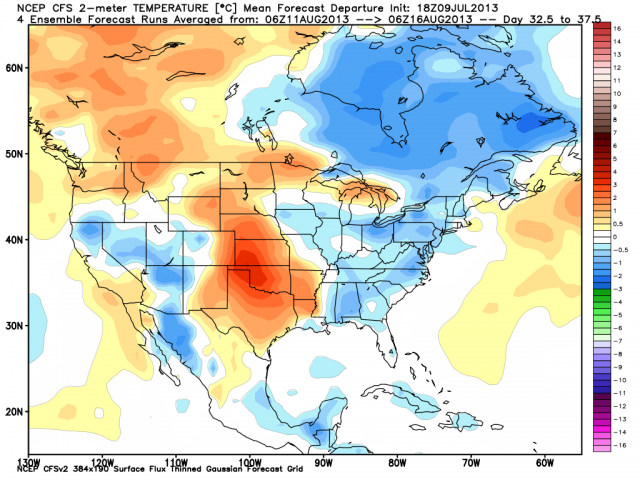
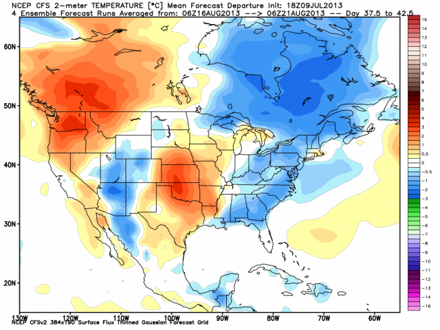
We are centering heat in the dry fry zone in the plains, which makes sense, and cooling big CDD areas east. The August part of the CFSv2 looks like this:
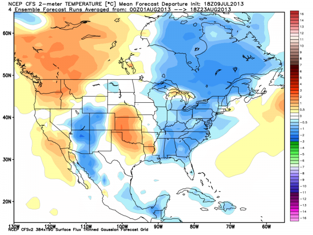
Which may mean my suspicions about continued downward adjustments over the northeast are needed. Why am I showing you all this? Because while the surge is coming out, unless you have been very dry, chances are it will be beaten back again, especially from the Mississippi east and over the northern plains. But, I want to be clear that phase 3 is a hot phase in mid summer, and we are headed that way, but the transience says that we go back and forth further. Dallas is hot much of the rest of the summer, yes. DC, back and forth. Cool area further west in southern Rockies...yes but hot further west. So, I want to have the jump on all this. Bet the hot card day 6-15, then back after that. TRANSIENCE, EXCEPT WHERE ITS DRY!
The indexes this morning.
PNA:
.png)
EPO
.png)
WPO
.png)