Bastardi-Attack of the Arctic Vort Max 13 years ago
January 2, 2012
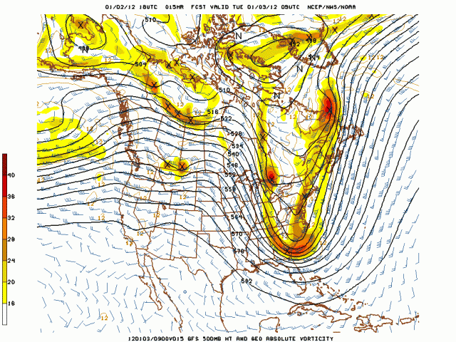
A nice snow squall just went through here, but the real fun and games may be shaping up for a lot of you tomorrow all the way to the coast as the arctic max I pointed out a couple of days ago can readily be seen coming south with a true shot of arctic air for the Northeast. I want you to watch this 12 hour through 30 hour 500 mb evolution off the 18z GFS run from Jan 2. You just don't see maxes starting near the north pole a couple of days before do this that often. Hopefully we will see the squall in most places to demonstrate the beauty of the meteorology here.
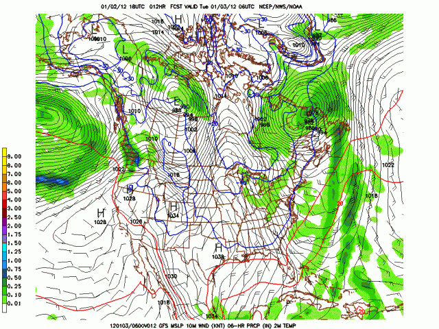
06z Jan 3:
09z:
12z:
.gif)
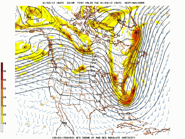
15z:
18z:
.gif)
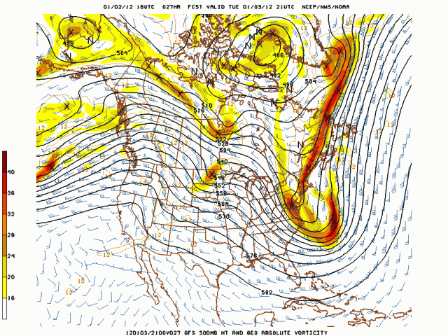
21z:
00z:
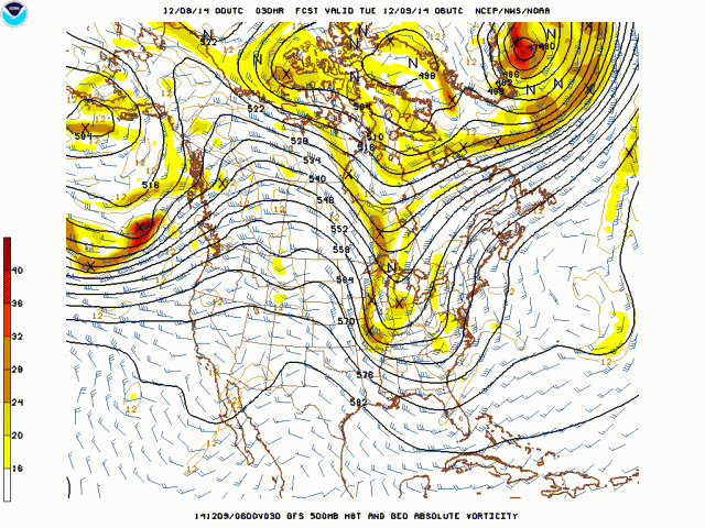
There could be some really wild squalls associated with this event all the way to the coast, since it has thermal support due to the drop in low level temps. Notice at 06z this am, the -10c line with the trough oriented west-east through northern New England over to east of Lake Huron.
Now look at 18z tomorrow how the -10C line has spread south.
.gif)
The surface trough is over PA. This is actually an arctic front, which is why I have 12F for a low temperature in NYC tomorrow night. The front comes through with direct discharge out of the north of the arctic air!!!!! It will be close as the model at 6z tomorrow night has -10C (14F) right over the city.
.gif)
But, this is how the model can bust, as it will tend to wash out such smaller scale events with in the large trough. Because the trough arrives tomorrow evening with instability, and a front so to speak, could lead to snow squalls that could cause mayhem to show up with snow that flies, melts, and then re freezes on roads.

I want to show you something. Look at the 384 hr 500 mb ensemble:
.gif)
Notice the cross polar flow into the immense negative over Canada and into the northwest. This is a set up for major cold. The cold core is forced southeast of the deep negative because of the positive over the top. Look at that pattern, and now look at this:
.gif)
This is the 500 mb anomalies centered on Dec 22, 1983.
Below are the temps for Dec 23-27:
.gif)
Cool eh? Mid and late winter this year will be very different from the opening of winter! Though late, we are going to the La Nina analog, transitioning in the means through the early winter pattern
Heres the days 8-14 500 mb forecast
.png)
Analog for December analog:
.png)
But lurking is the second part:
.png)
It looks like we are headed toward there as we are finally seeing the pattern evolve.
When this winter is totaled up, the theme will be a case of late, but not never as far as the sensible weather goes. AND REMEMBER THAT MEANS ITS NOT AS BAD AS LAST WINTER. I keep having to say that because that is what was in the winter idea. That being said, this winter is far from over and has a wilder look around the corner.
Heres the view from the backyard of the Edinboro wrestling coach Tim Flynn from earlier today.

ciao for now