Final Summer 2026 Forecast 1 month ago
May 27, 2026
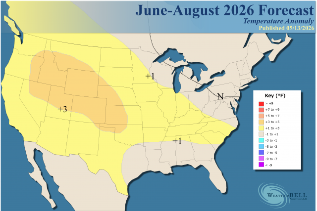
- The forecast is tricky due to early cooling in the South and East and the evolving threat of major heat in the Plains.
- Any error in the forecast is likely that we are not quite warm enough.
- The heaviest rain will be in the next week or so.
- An early-season tropical impact is possible in the Gulf.
- Texas and the southern Plains may be sluggish early, but expect more warmth from mid-summer onward.
- Dry areas over the last 30 days and the upcoming 30 days will be the hottest in the longer term.
- An increase in rainfall in areas farther to the east can blunt the heat.
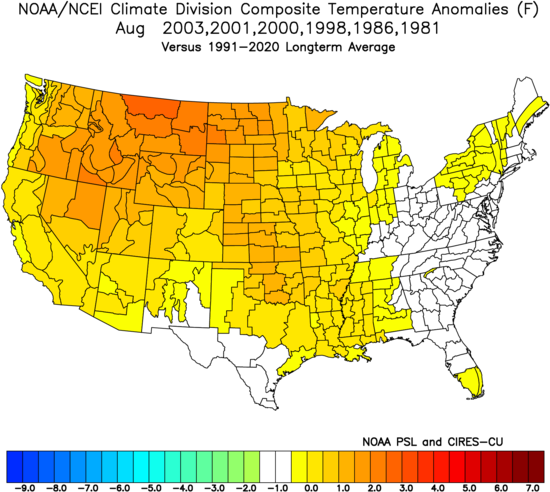
Analog:
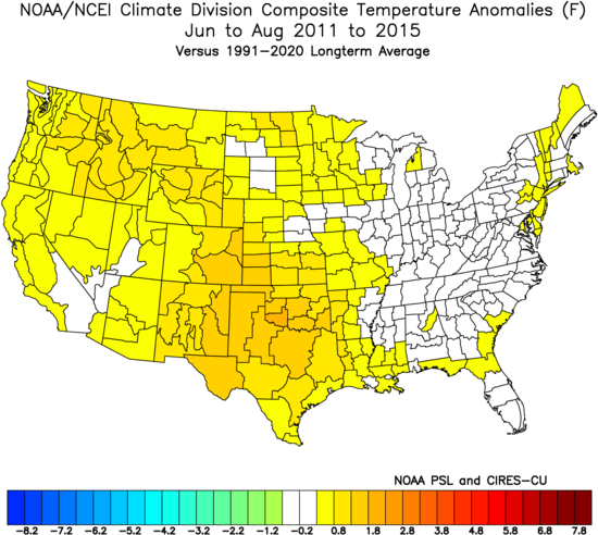
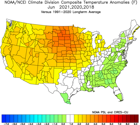
This is actually the coolest Euro summer forecast since 2023, the year the strong ONI El Niño (much less in other measurements) occurred. However, there is more concern about the Plains being hotter than this:
.png)
Last year:
.png)
2024:
.png)
2023:
.png)
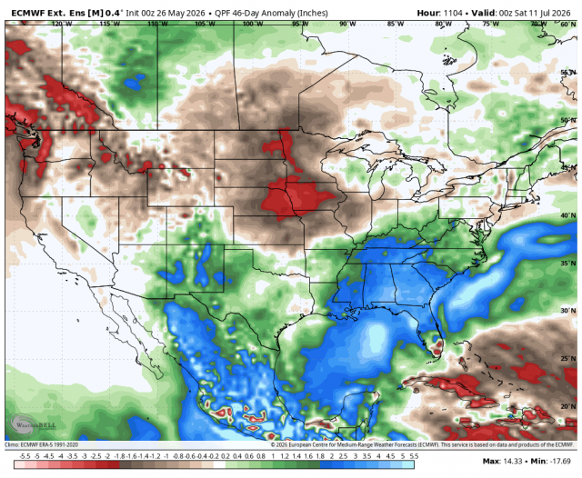
Precipitation anomalies for the next 45 days:
The last 45 days:
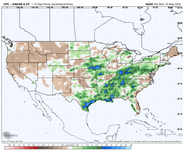
So it has picked up, but looking forward, a lot of drying will be occurring over the Plains.
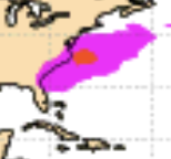
An early-season tropical impact is possible in the Gulf. We have been on this for quite some time. An MJO rotation into Phases 8, 1 & 2 is expected in June, and the eastern Pacific should come to life soon. That would then progress into the Atlantic Basin, where the central American gyre can spit something out into the Gulf.
The Euro probabilities for the first week of June:
If it works up into the South, heavy rainfall can help blunt temperatures for the remaining part of the summer. Texas and the southern Plains may be sluggish, but expect more warmth there from mid-summer onward. We can see that in the monthly Euro forecasts.
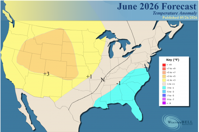
June
Analog:
June Euro Seasonal:
.png)
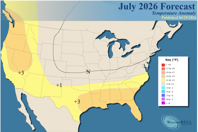
July
Analog:
.png)
July Euro Seasonal:
.png)
This is where I am concerned that we will have to increase temperatures much more in the Plains and Texas, as the drying occurs.
August
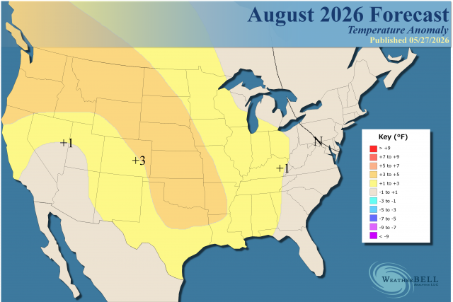
Analog:
This could really be hot in the Plains. How far to the south that gets over Texas will determine how much population is involved in the heat.
August Euro Seasonal:
.png)
Cold water off the Northeast coast keeps getting forecasted to reverse, and it hasn't so far. The Euro forecast for May from 5 months out:
The current reality:
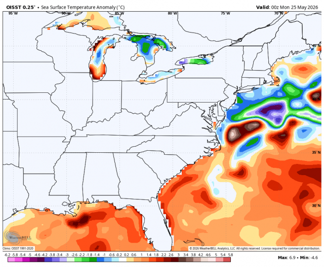
So a flip keeps getting forecasted, and it has not occurred.
For the past few years, SSTs off the Northeast coast have fallen dramatically. Look at 2022:
.png)
The Verdict
I believe the Northeast and Great Lakes will have fewer CDDs this summer, but trying to go too far against the 10-year means is not wise. So we have CDDs only a bit below the 10-year but above the 30-year average. The core of Texas should see heat in July and August, and the current map may be underdone as July may be hotter (August already is). The Northwest into the central Plains looks like where things can really bake. In fact, unlike other years when it was the nighttime lows that carried the means, in the Northwest, the daytime highs may be the key. Increasing precipitation in the East makes any warm forecast a bit dicey there.
We have been alluding to an early-season tropical cyclone. Since the Main Development Region may be void of activity in the heart of the season, in the land of the blind, the eyed man (an early-season event) may turn out to be king (the most important event). There is no reason to back away from the concern, given the pattern's evolution.