Final Summer 2018 Forecast 7 years ago
May 30, 2018
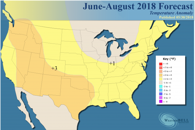
- Large scale warm summer expected.
- Likely the warmest since 2012.
- Center of heat will be over Texas and into the West.
- Cooler East Coast in June but warm water means July-August should be above normal.
- There is a worry about a cooler August.
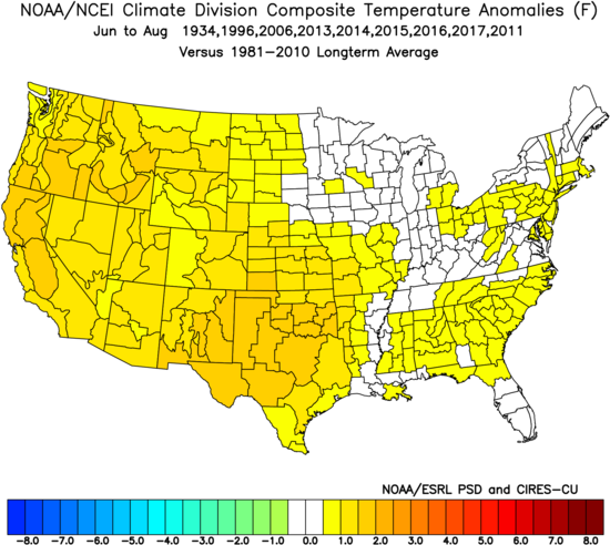
The analog package includes four holdovers from last year - 1934, 1996, 2006 and 2011. Also joining the bunch are the last 5 summers
.
A cooler shadow is developing over the East in June. I am reluctant to go below normal in the East because the warm water off the East Coast argues at the very least for higher overnight lows.
The remarkable performance of the analogs that went into last winter continues, as they predicted a fast start to the winter, a backing off and then the cold that ended the HDD season. They also indicated a strong flip would occur in May. This was shown on the 30 day outlooks. The analogs now argue for a hot, dry summer centered in Texas and the West. We use those and then the past 5 summers as analogs, and it comes up pretty darn close to the European Summer forecast, though the Euro is warmer in the northern Plains.
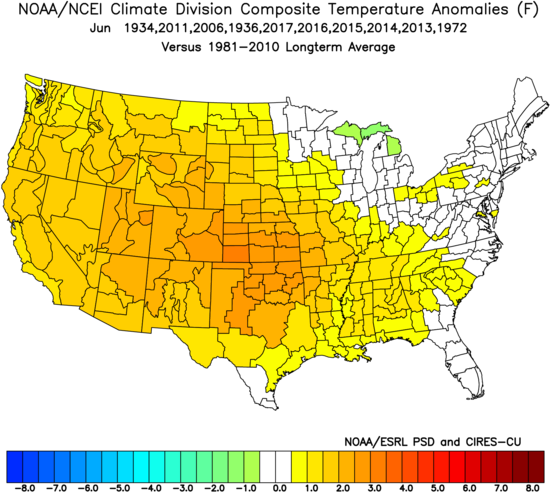
June
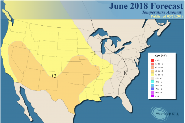
Analog:
July
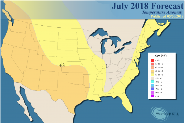
Analog:
.png)
August
In past transitions toward an El Niño one of the two months, July or August, comes up cool. We have chosen August as the month to look for that.
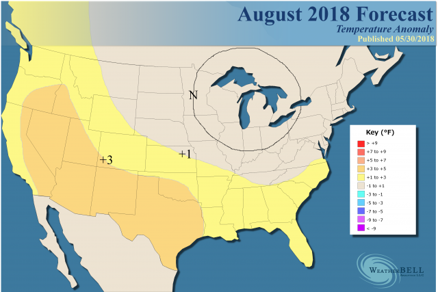
Analog:
.png)
We have a large scale warmer than normal summer ahead of us. The big CDD area will be from Texas northward into the Plains and then back into the West. The East will be open for less warm, or perhaps cool weather, but warm water off the East Coast argues for higher overnight lows that will skew that and it's tough to go below average there. Though not as hot as 2016 or 2012, it does look hotter than last summer and the three before 2016.