April Update to Summer 2017 Forecast 8 years ago
April 28, 2017
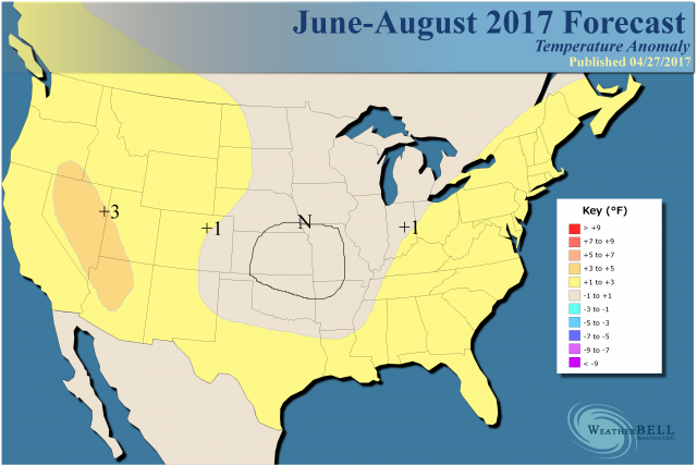
The heart of the summer is expected to look like this:
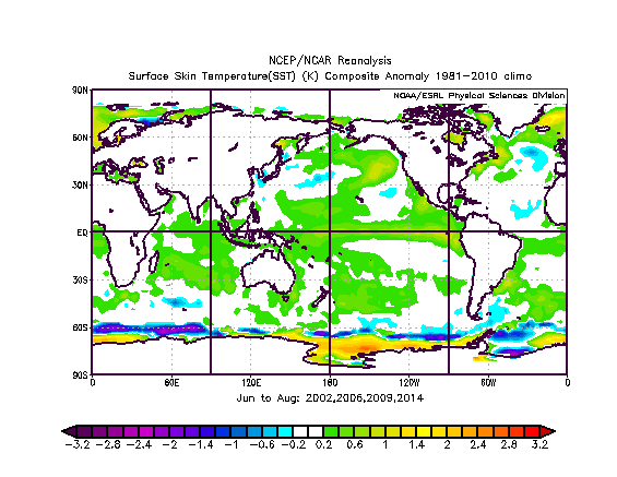
The forecasted SSTs for the heart of the summer:
.png)
Those analog years:
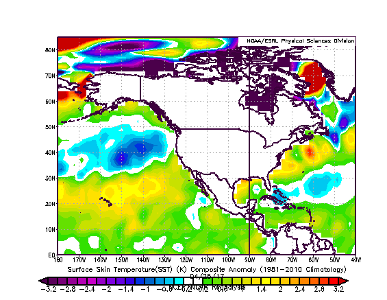
We certainly see an El Niño emerging like in those years, but we are currently different to the west of Australia and in the northeastern Pacific. The Atlantic has the look of less hurricane activity in the Main Development Region, and there is no change to that idea.
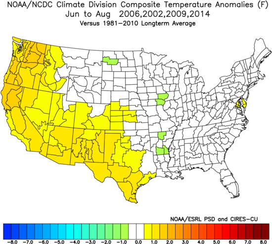
When looking at the selected analogs for the summer, I am using warm AMO-era summers with weak to moderate El Niños evolving. So the summers we are looking at are 2002, 2006, 2009 and 2014. I did not select the summer of 2004, which was abnormally cold, though you can argue that it should be included. In any case, we come up with this:
One thing we are looking at is the amount of rain we are having over the next 46 days. The Euro is very wet:
.png)
Normally that is a real indicator, along with the evolving El Niño, for a coolish summer from the Plains eastward. However the water is extraordinarily warm around the U.S. this year:
A blend of the selected analogs:
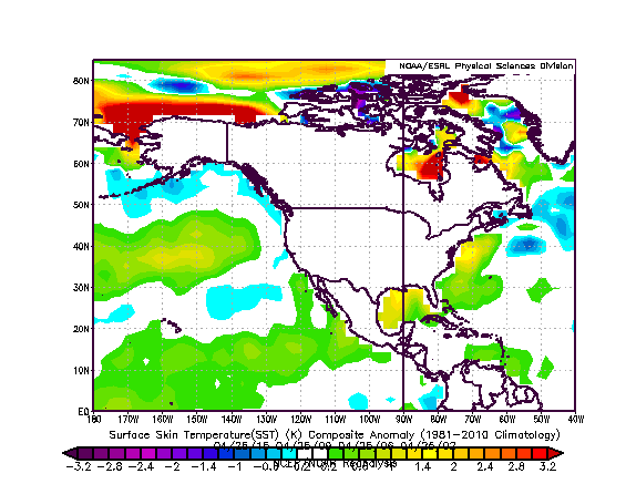
Interestingly enough, the SSTs are quite a bit colder in Hudson Bay, as Canada has been cold the past couple of months.
One thing I am not jumping on is the endless summer scenario. I don't think DC gets over 40, 90°F+ days this summer. Overall it looks cooler than last year, but I would not yet call it cool. September is a very tough month, at the end, just like May is at the start. I have brought up several times the crazy May of 1977 and April-May 1976, both with major warm shots but some outstanding countering cool. September was nasty in those months, as we have seen very warm ones and very cool ones. Most modeling from a distance has been quite warm, but I wonder with the global temperatures going down and the chill now showing up in Canada if they will trend downward, too. The CFSv2 and Euro were caught completely off guard by what is coming in May.
The Euro:
.png)
Latest 46 day CFSv2:
.png)
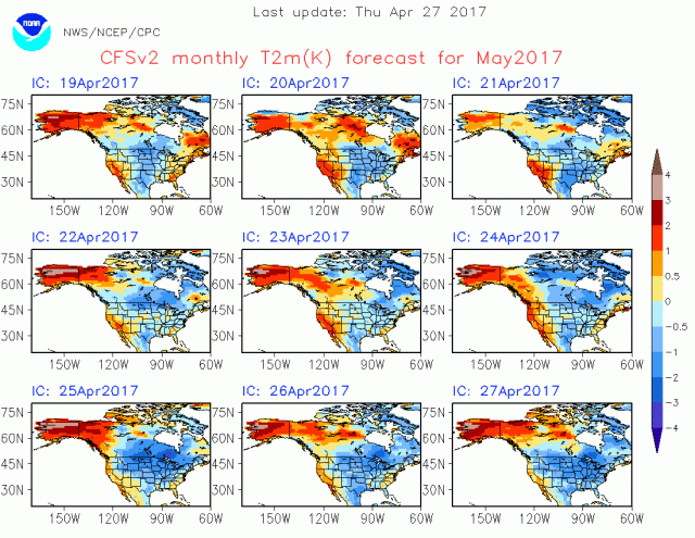
CFSv2 from the front of April for May:
.png)
CFSv2 now:
.gif)
This is rivaling the November 2014 debacle, as the model gets colder on every run:
The question, of course, is where do we go after here? Last May cooled and then summer was well-behaved against our forecast. This year I don't see it as hot and the threat of a cool look in the nation's midsection is especially greater.
Again, there are no changes to the hurricane forecast. It is interesting to note that the blend of those years gives us an ACE of 71, but that is with the El Niño of 2004 thrown out. Still the analogs support our hurricane idea.