2025 Hurricane Season Forecast July Update 9 months ago
July 7, 2025
- We have taken the seasonal numbers down a bit.
- The Main Development Region should see near-normal activity.
- In-close development is going to be a headache.
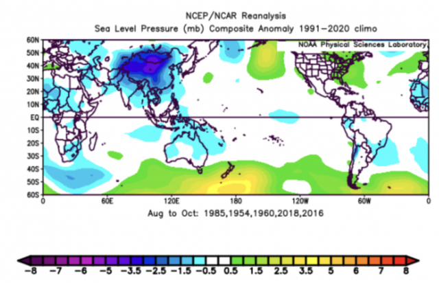
- The chief analogs for the rest of the season are 1954, 1960, 1985, 2016, and 2018.
Saffir-Simpson Hurricane Wind Scale Forecast
Named Storms: 14-18
Total Hurricanes: 6-8
Major Hurricanes: 2-3
ACE Index: 105-135
ACE/Storm: 7-8
Impact Forecast
Tropical Storm Conditions: 4-6
Total Hurricanes: 2-3
Major Hurricanes: 1-2
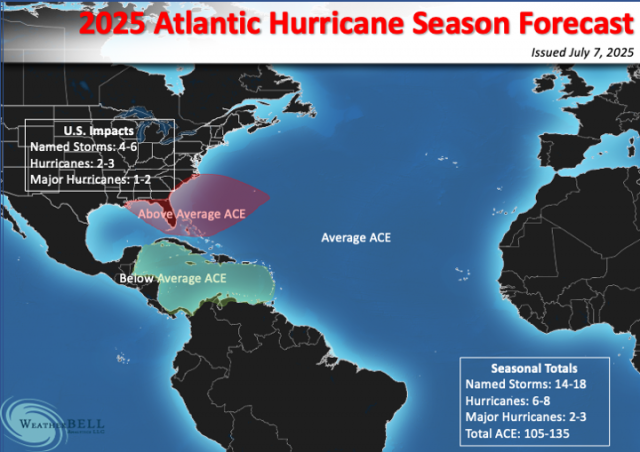
The red area is expected to see more than 50% over average ACE, while the green area in the Caribbean should see less than 50% of the average. Other areas should see near-average activity.
The changes mainly reflect what we have seen so far this summer with the overall pattern over North America. The pattern is strongly distorted due to above average temperatures and 500mb heights across the north and below average underneath moving farther back to the west toward Texas. This implies that a scattershot season is still a good idea with above average ACE away from the Main Development Region. A look at the analog years reveals an equal spread along the coast, though I am partial to focusing on the Southeast again.
Sea-level pressure for August-October in the chief analog years:
The Euro Seasonal's sea-level pressure pattern is similar:
.png)
The Atlantic basin SSTs during analog years (adjusted for warming):
The Euro Seasonal SST forecast:
.png)
The 500mb pattern during analog years:
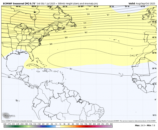
The Euro Seasonal's 500mb forecast:
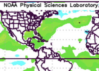
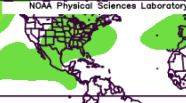
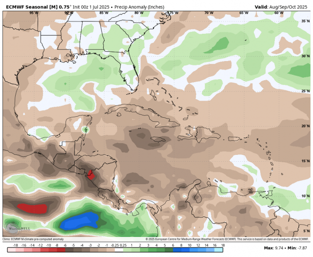
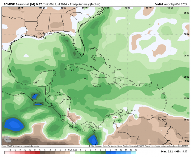
The Euro Seasonal's precipitation forecast (top) for August-October is vastly different than last year's forecast (bottom):
A look at the analog seasons still includes 1954. There were similarities between May this year and May 1954, so that might be tested. The first three analogs are, of course, not as recent as 2016 and 2018. If we look at those years, you can see all of the development away from the Main Development Region.
Storm tracks during the 2016 Atlantic hurricane season:
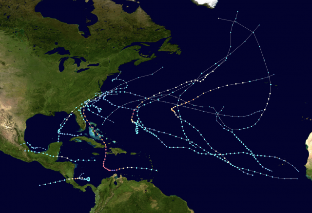
Storm tracks during the 2018 Atlantic hurricane season:
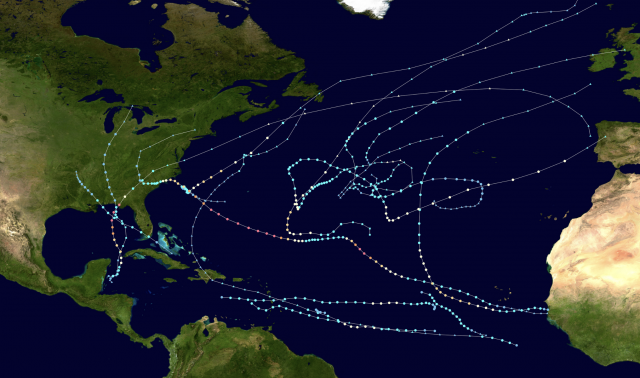
Of all those storms, only Matthew strengthened south of 22.5°N, so the impact idea now focuses from Louisiana to the Carolinas, but we can't rule out storms breaking out of the pack up the East Coast or westward to Texas. We are pulling the above-average area closer to the United States, with below normal conditions across much of the Caribbean. The warmth of the water ups the ante for in-close feedback, something that has become more common in the age of water warming farther to the north. Systems that are smaller in size and intensify rapidly within two days of the coast are what to watch for.
The Verdict
The total numbers have been taken down from our first two seasonal forecasts. The Main Development Region should see near-normal activity, but most of the threats to the U.S. will be from in-close developments.