Winter Seasonal Forecast Update 9 years ago
October 27, 2016
- Extreme cold December possible
- Analog technique favors back and forth with leftover colder than normal January/February
- Still relatively high uncertainty
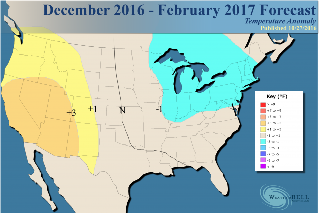
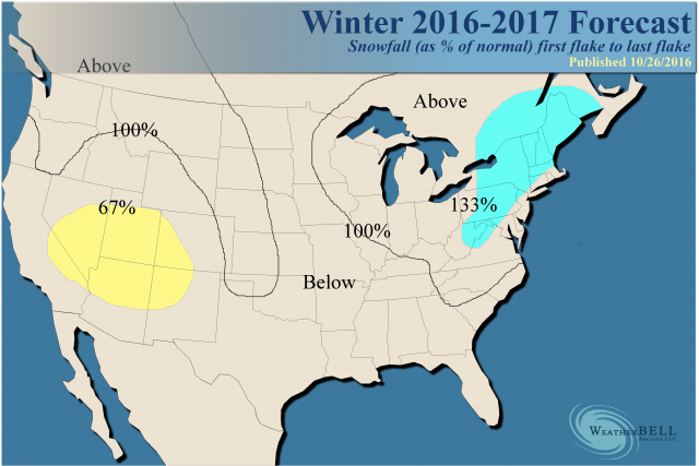
- Swath of above normal snows over Pacific Northwest to western High Plains and in the Great Lakes and Northeast
- Texas, southern Plains and Southeast look milder
- Core of cold should stay mainly to the north
Our snowfall forecast has changed, relying on the cold to produce both Lake Effect and large scale storms over the interior Northeast. The big news is that the core of the heaviest snow is back to the northwest but the big cities should be above normal anyway. While there should be a western ridge, there is likely to be enough coming through the ridge to enhance snows in the Pacific Northwest into the High Plains, where we think precipitation will be above normal overall.
Discussion
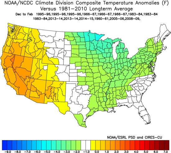
The WeatherBELL team has settled on the strongest analogs of 1966-67, 1983-84 and 1995-96 with 2013-14 double-weighted and single weights to 1960-61, 2005-06, 2008-09 and 2014-15. The pure analog is colder, but to adjust for modeling that is warmer and a more modern climatology, a degree was added across the board.
The analog:
We think that December has a chance to be very cold, but we are not ready to go the most extreme solution at this time.
.png)
December Analog:
.png)
Things should be fairly seasonable, on average, for January in much of the East:
.png)
Analog:
.png)
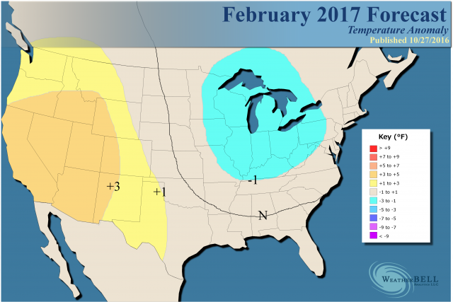
I think the mid and late winter will be back and forth, still biased cold over the Northeast, Great Lakes and Midwest.
Analog:
.png)
The years in question have an SST pattern like this (every 0.2°C):
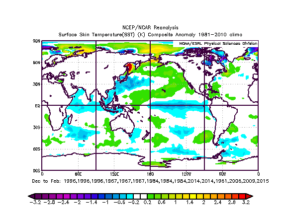
We do not believe the La Niña will be this strong, but you can see the warm ring in the Pacific (even with the La Niña seen here) gives a cold result in the analogs. Again, we have adjusted the temperatures up a degree, given the uncertainty. If you combine the pure analogs with the idea the La Niña may be a non issue, you can see an equal chance for a colder and a warmer scenario than we have depicted.
Essentially, we are in the middle but are worried about the kind of major cold we are now seeing in Asia showing up for late November and December.
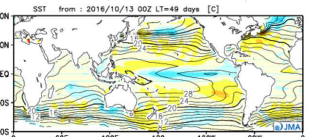
The current SST analog winds up with this for its SST projection:
.gif)
The JMA forecast:
JAMSTEC:
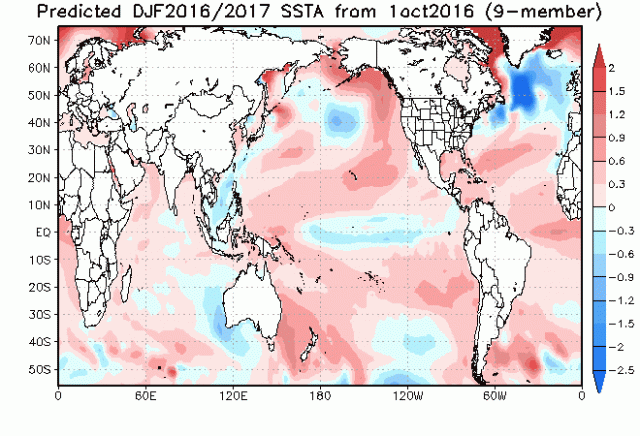
The CFSv2 seems to again be trying to push cold to the West Coast and is much stronger with its La Niña forecast:
.gif)
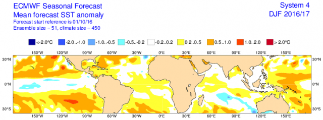
The Euro has a less robust La Niña:
The WeatherBELL Pioneer model, which takes into account the SSTs but many other variables, has done a great job at 500 mb in recent years. This year there is no Super Niño to distort low level temperatures like last year. The 500 mb for the winter gives us this and looks much like the Euro, which is perhaps a bit farther to the west):
.png)
Temperatures:
.png)
Texas looks to be a major temperature headache, as the battle goes on between the cold that is aimed into the East and the western warmth. I have enough back and forth for a normal winter but am worried it could be warmer there, even as it's colder farther to the northeast.
The Verdict
A colder and snowier winter is on the way for the Great Lakes, Northeast, much of the Midwest and Mid-Atlantic, with warmth centered in the West. The warmth could also extend across the South. There is a danger of major cold from Thanksgiving to New Year's. As far as later in the winter, we will evaluate that as we get closer. Given the worry about December, it has been made the coldest month, with some backing off in January. February is bound by a greater uncertainty with how far out it is.
Overall in terms of the last 8 seasons, this would be the fifth coldest out of the eight. The worst case it could wind up in the top 3, though. I seriously doubt it would be warmer than the warmest three.