2015 Preliminary Hurricane Season Forecast 9 years ago
March 15, 2015
- Another low ACE year in the Main Development Region
- In-close development biggest problem
- Abnormally warm central Gulf of Mexico enhances threat of major U.S. hit
Forecast
- Named Storms: 7-9
- Hurricanes 3-5
- Major Hurricanes: 1-2
- ACE 65-80% of normal
Commentary
The overall season seems fairly straightforward. It is highly likely that the ramped-up number of storms and ACE era is fading as the Gray/Klotzbach long -running AMO, which I think is the gold standard of the AMO index, is now heading to the negative phase. The NOAA measurement, while backing off is not quite there yet:
.png)
SST forecasts and pressures on the ECMWF are the kiss of death for the threat of even an average season in the Main Development region. Like last year, we are emphasizing a less than average threat to areas south of 22.5°N.
ECMWF SSTA Forecast:
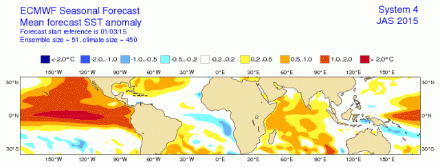
This is the kiss of death as it implies lower than normal pressures over the Pacific and northwestern South America, enhanced (and a strongly hostile) western Caribbean Index (my research), with greater than average pressure differences between Northwestern South America and Jamaica. This implies stronger than normal easterlies west of 50*W and net sinking in the tropical Atlantic basin.
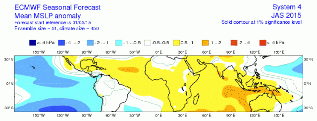
The ECMWF pressure forecast shows higher than normal pressure expected:
The ECMWF rainfall forecast:
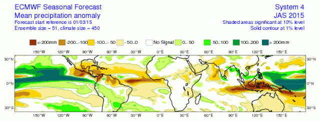
These both echo the theme that below normal activity should be expected.
However, the problem is the SST near the U.S. coast. The current SSTA pattern:
.png)
This features a very warm central Gulf of Mexico. I am also trusting the models warming the water off western South America.
As it stands now this is a look for an average ACE season, but is really one where you forecast a lot of landfalling storms, as the region of greatest convergence (given this SST pattern) would be in the western Atlantic basin. Any cold water is assumed to warm. If it does not, then the landfall threat, which I think is greater than average anyway in spite a smaller than average ACE, would be even greater.
The current map off the West Coast of South America is a favorable signal, reminiscent of weak ENSO3.4 warm events like 1969 and 2004 that produced bigger hits. That being said, the cold AMO ring and the cold off Africa is instantly a negative.
In any case, the seasons with hurricanes in the major energy areas of the Gulf had an average March SST like this:
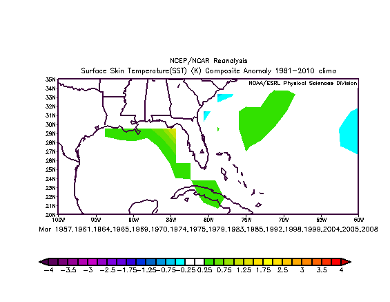
The closeup of the Gulf as it stands now should open your eyes:
.png)
Last year we had a good forecast, though for it to have been what I objectively needed was one more hit on the U.S. East Coast. It turned out the congregation of storms occurred about 300 miles farther east than what our forecast was.
The Verdict
Overall intensity should be close to last year.
The common thread is that the farther north we are, the greater the intensity relative to normal. So this is not a "lah de dah" season.
The impact map will be out by mid April. My gut feeling is the shift will be to the west this year as we cannot ignore the early season Gulf of Mexico above normal SSTs.
I think the threat of major hit is higher than average on the U.S. coast, and the energy areas of the Gulf of Mexico are in that boat.
Note
A map of risk assessment will be provided in April.